Hiking Recap for 2023 and Update
Leave a reply
I didn’t blog as much as I wanted to in 2023 because I was lost in a sea of social media apps, and I had no idea which ones I should focus on. I tried to maintain a presence on Facebook, Instagram, Threads, X, Snapchat, WhatsApp, Spotify, rumble, YouTube, and I just created a TikTok account. After trying to keep several apps updated, I finally realized the futility of that and decided to mostly focus on Instagram. Now, I have 487 posts, 2,686 followers, and I’m following 3,997. I reach over 1,000 accounts per month, but haven’t earned anything. I’m eligible for gifts and branded content, but haven’t had any luck with those. I found it hard to gain followers on Instagram.
I have a great gallery of photos and videos to document my hiking and climbing activities, but I’m a writer, not a photographer. So, I’ve explored the jungle of social media and returned to my blog site to write.
In my personal life, I’ve struggled with a lot of stress and anxiety. Most of that is related to the PTSD I have from my combat experiences in Operation Iraqi Freedom. I’m also working fulltime as a civil engineer. I have a long backlog of projects that I’m drowning in. I enjoy the work that I do, but I’m tired of the daily grind of clocking in and out. Fortunately, I get to telework most of the time, but that has some drawbacks, such as the isolation. Being isolated from in-person social interaction is challenging at times. I’ve always been an introvert, but now I feel more isolated from society than ever. I’ve retreated deeper into my cave of consciousness.
The best mental health therapy I have is from hiking and climbing in the mountains. I try to get outside and hike at every opportunity. It is the only thing that I’ve found to reset my state of mind. I’m sure the antidepressants an anti-anxiety medicine helps some. Hiking is the topic I want to discuss with you.
After getting a Garmin Instinct watch as a Christmas gift, I’ve been using it to track my recreation activities. It provides so many statistics about me that it is somewhat overwhelming. I cling to it about the same amount I cling to my cell phone. They might as well be built into my body. My son is the same way with his Garmin, he doesn’t go anywhere without it.
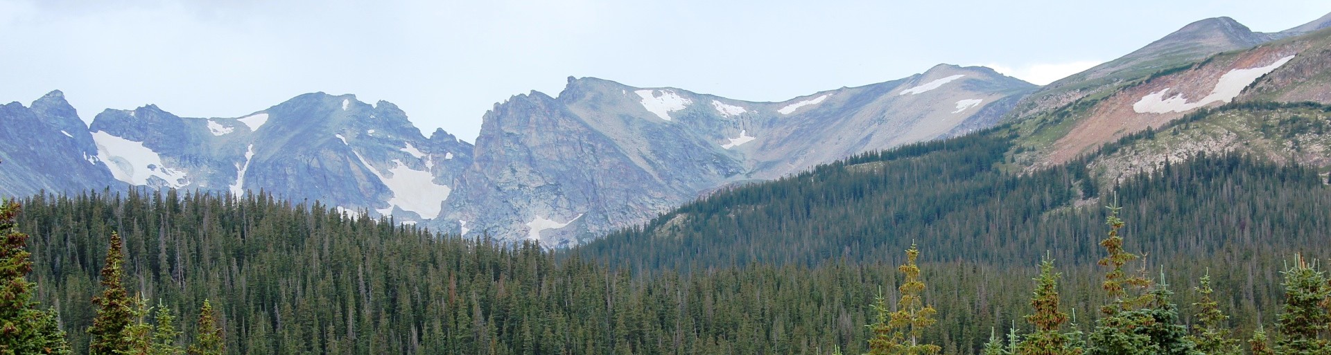
Did you set any recreation-related goals in 2023? If so, please provide some details in the comments. In 2022, I set a goal of hiking 1,000 miles, which I exceeded. I made it to 1,157 miles. I sense that is a good distance, especially for a 59-year-old guy, a little overweight, and with neuropathy. I didn’t set a goal for 2023, but vowed to hike as much as possible for my mental and physical health. Hiking in the mountains also helps me spiritually. I’ve always viewed the mountains as my church, the place I feel closest to God. I had a number in mind that I wanted to reach, but I wouldn’t have been disappointed if I didn’t get there.
For me, keeping track of my adventure statistics is a means of motivation. I’m an engineer with a strong math and science background, so I’m an analytical type of person. I like to compare my progress from year-to-year. I’m sharing my information as an example. You should base your goals on your abilities, interests, and available time. This should be about tracking your hiking so you can see how you are doing compared to how far you want to hike. You can use your data to develop limits for easy, moderate, and difficult hiking distances. I discovered that 0–5-mile day hikes are in my easy range, 6-10 miles is in my moderate range, and 11+ mile hikes are in my difficult range.
You need to adjust your ambitions based on your fitness level, gender, and age. After an excellent year of hiking, I finished the year feeling good about my fitness level. I hiked as often as I could. I’m not a competitive hiker or trail runner.
For comparison, I’m sharing my data for 2020 – 2023, and for my lifetime (see the table below). Because of mandated travel restrictions in 2020, I didn’t have much hiking time in the mountains. So, I didn’t get much vertical gain that year. Most of my hiking in 2020 was in nearby open spaces. For 2021, I entered a Map My Walk App challenge to hike as many miles as possible. I challenged myself to get as much vertical climbing as I could. I finished in the top 9% of people in the challenge. That was a motivator for 2021, but not the most important one. My biggest motivator was a need to relieve stress and to decompress. In 2021, I used a Garmin Instinct watch and the Map My Walk App on my phone. That allowed me to compare the accuracies of each against each other. They were within 5% of each other.
In 2022, I switched to only using my Garmin because the Map My Walk App drains my phone battery too fast. I liked the app and used it for seven years. But I love the Garmin Instinct. On the topic of hiking apps, the free Colorado Trail Explorer (COTrex) application is a great map tool. It provides an accurate topographic map and is useful for navigating when hiking on or off trail. I use COTrex to check elevations, my location, and vertical gain. Over the past year, my Garmin Instinct has started inaccurately estimating my vertical gain. Sometimes it is off by 2,000 feet. When it is wrong, I edit the data so I have the correct statistics in my Garmin Connect account.

About my “lifetime” statistics, I’m still compiling the data. I did a lot of hiking, climbing, and backpacking before I cared about keeping statistics. When I have time, I look back through my handwritten diaries to see if I wrote anything about the distances I hiked or mountains I climbed.
After I retire, which isn’t far off, I’m going to get back to doing more climbing. There are thousands of mountains to climb in Colorado alone. In fact, my best tally to date is 5,647 mountains. That number is from a variety of sources, but I’m still researching more sources. I’ll probably focus on climbing the remaining of the 696 peaks above 13,000 feet elevation that I still want to climb.
I hope you have a wonderful year. Get out to enjoy outdoor recreation as often as you can. Nature, sunshine, and fresh air is good for your body and soul.


Global Warming for Dummies. An objective and scientific view of climate change or climate alarmism.
Climate Change or Climate Alarmism? A Rational Discussion

Your gear will vary depending on what kind of hiking adventure you are preparing, however whether you’re backpacking the Appalachian Trail or preparing a day trek with your household, there are some pieces of hiking gear you ought to always remember.
Important Hiking Devices: Things You Required Before Hitting The Trail

If you want to set hiking goals for the new year, you should develop a reliable way to log your hikes. A fitness app and GPS device will most likely record the data for you. You should download the data for your records, so you have them for future reference. If you don’t have a smart phone, you can log your hikes in a spreadsheet. There is nothing wrong with going minimalist and not recording anything if that is best for you. I’m an engineer with a strong math and science background, so I’m an analytical type of person. I like to compare my progress from year-to-year. I’m sharing my information as an example. You should base your goals on your abilities, interests, and available time. This should be about tracking your hiking so you can see how you are doing compared to how far you want to hike. You can use your data to develop limits for easy, moderate, and difficult hiking distances.
You need to adjust your ambitions based on your fitness level, gender, and age. After an excellent year of hiking, I finished the year feeling good about my fitness level. I hiked as often as I could. I’m a male. I was 56 for five months of the year and 57 for the rest of the year. I’m not a competitive hiker or trail runner. I have a full-time traditional job. I also have peripheral neuropathy in my feet, which causes significant pain. Peripheral neuropathy is a disease that damages the sensory nerves. It causes pain, numbness, tingling, and reduced circulation. I get some relief from medicine, compression socks, and good hiking boots.
I also count walking for exercise in my hiking miles, but not walking as a normal part of the day. If I’m on a trail, I log it as hiking. If I’m on a regular sidewalk, I call it walking. I don’t do a lot of jogging, but I also count jogging around a track or elsewhere since it is time dedicated to exercise.
For comparison, I included my data for 2020, 2021, and for my lifetime (see the table below). Because of mandated travel restrictions in 2020, I didn’t have much hiking time in the mountains. So, I didn’t get much vertical gain. Most of my hiking in 2020 was in nearby open spaces. For last year, I entered a Map My Walk App challenge to hike as many miles as possible. I challenged myself to get as much vertical climbing as I could. I finished in the top 9% of people in the challenge. That was one motivating factor for last year, but not the most important one. My biggest motivator was a need to relieve stress and to decompress. I used a Garmin Instinct watch and the Map My Walk App on my phone. That allowed me to compare the accuracies of each against each other. They were within 5% of each other. I’m planning to only use my Garmin in 2022 because the Map My Walk App drains my phone battery too fast. I liked the app and used it from 2014 to 2021. But I love the Garmin Instinct. On the topic of hiking apps, the free Colorado Trail Explorer (CO Trex) application is a great map tool. It provides an accurate topographic map and is useful for navigating when hiking on or off trail. One drawback is that it is only for Colorado.

About my “lifetime” statistics, I’m still compiling the data. I did a lot of hiking, climbing, and backpacking before having the conveniences of modern technology. For several years I kept track of my hiking information by writing it in a paper notebook. I wasn’t consistent about doing that. I’ve used Excel spreadsheets for a long time, but I didn’t always record my information in there either. No matter what system you use, it takes discipline to collect the data.
Now I have good baseline or benchmark statistics to compare this year with. I found that 10 miles is at my upper limits for a hiking distance, and that 5 to 7 miles is a comfortable hiking range for me. My average hike in 2021 was 5.0 miles. I hope you have a wonderful year. Get out to enjoy outdoor recreation as often as you can. Nature, sunshine, and fresh air is good for your body and soul.


The following is an excerpt from a book I wrote titled Rocky Mountain Adventure Collection. I will also provide this as a podcast if you would rather listen to it.
During my alpine adventures, I often push my courage to the edge and tell myself, “never again.” Then, a month later, the magnetic lure of high-country adventure draws me right back to the edge. Figuratively, the edge is the limit of my mountaineering ability. Literally, the edge could be the edge of a cliff, the boundary between safety and danger. The thin line between life and death.
This is a short story about an eternal moment. It is one of my experiences of being on the edge. The incident happened on a rock outcrop on a mountainside. We were above timberline in the Indian Peaks Wilderness Area in Colorado. I was with one of my best friends and trusted climbing partner, Craig. We started out on what we intended to be an easy climb up an unnamed mountain. As often happened, our easy-going climb turned into a hairy situation. We weren’t thrill-seeking but trying to find our limits.
Our experience on Dripping Water Rock on 14 July 1984 put us in the grip of death. That is third on the scale of nearness to death. The scale, from best to worst is near death, very near death, in the grip of death, and at God’s mercy. To put this into perspective, on our descent of Mt. Princeton’s Chalk Cliffs we were at God’s mercy. When mountaineers are at God’s mercy, they are beyond their limits in near death situations. On wrong move could be your last move. Free solo climbing is an example of being a God’s mercy.
Everyone who ventures into the mountains should know the limits of their abilities. We were young and still finding our limits. Sometimes you don’t recognize your limits until you are on the brink. Sometimes your adrenalin is flowing so high that it overtakes your fear instincts. That is what happened during our afternoon experience at Dripping Water Rock.
Our goal was to reach the top of an unnamed 11,000-foot peak. That put us on a grassy summit above timberline in the subalpine zone. It was an easy climb. The weather was spectacular. After a short rest we felt an extra boost of energy from the sunshine soaking into our skin. The peak was at the lower end of a ridge that forked off from the Continental Divide. Farther up the ridge, higher peaks called on us. I was almost always up for an extra challenge. So, we followed the ridge up toward the divide over several intermediate high points. Although the divide was a tempting target, it was too late in the afternoon to make a serious run for it. We decided to keep climbing until our instincts told us we should turn around to start back down.
Above 11,500 feet, the ridge grew narrow and jagged. It is a strip of the mountain between two valleys. Glaciers carved away rock from each side leaving a hard-rock spine between them. These glaciers still existed only 10,000 years ago. The tougher terrain slowed us down some. The sky grew ever darker with thunderclouds forming. Since thunderstorms could form with little notice, we took that as a warning to get to lower ground. Another warning came as a gust of wind. We knew that play time was over and we needed to get off the exposed ridge. I didn’t want any part of descending that ridge during a thunderstorm or even a rain shower. Your traction on wet terrain is about 30% of what it is on dry terrain.
The sides of the ridge were too exposed to make a safe descent, so we backtracked down the spine of the ridge. After several minutes of backtracking, the ridge sides became less steep. The U-shaped valley below looked beautiful. The valley was grassy and spotted with rocky knolls. Alpine streams with connecting pools meandered across the landscape. After a couple of hours on the barren, rocky ridge, the valley was appealing. To get down faster, I proposed a shortcut down the steep-sided ridge. Craig wasn’t keen about that idea but agreed to try it.
It wasn’t as steep as it was higher up, but it would still be a challenge to descend. It was a hard class-3 mountainside. Not too difficult, but not something you could do in your sleep. We maintained a three-point climbing technique while making the descent. That meant we only moved one limb at a time with the other three limbs gripping the mountain. We were careful to stay out of each other’s fall line since it was easy to dislodge rocks. The sound of falling rocks unnerves me. Sometimes a climber is falling with those rocks.
Then, midway down the mountainside, we came to a sheer edge on the ravine we were following. We were descending alongside a trickling stream in the bottom of the ravine. Unfortunately, the ravine ended with a cliff. From there the stream became a trickling waterfall. This is also known as being “cliffed off.” We didn’t feel like backtracking up the ravine, so we analyzed the terrain for other options. We saw one possible way to skirt around the edge of the cliff to get back on “safe” ground. We would have to traverse a slanted ledge that looked wet. Below the slanted ledge was a deadly vertical drop. Wet rock meant less friction. We suspected the ledge led to safety, but we couldn’t see past a large protruding rock mass. It was a situation on the borderline of requiring a rope belay for fall protection. But we hadn’t planned to do any technical climbing, so we didn’t have a rope with us. Our two choices were to take a risk crossing the ledge or to climb back up and around the obstacle.
Rather than back climbing, we decided to try traversing the ledge. We started across the ledge using a spread-eagle posture to maximize body contact with the rock. That would give us the most traction or friction force. We inched our bodies across the rock in an undulating motion. Our situation transformed into an ugly bear. Committed to the ledge, we traversed beneath an overhang, still on the sloping ledge. I could see a void of space off the edge of the ledge where gravity was tugging on me. Ahead there was a section with water trickling over the rock overhang onto the ledge. That meant we had to cross a section of slippery rock, slanted down toward the cliff with water dripping onto us. The drop off was a vertical rock face onto a steep mountainside.
We were in an uncomfortable position to say the least. I hugged the sloped granite slab and clung to fingertip holds. Body friction kept me from slipping over the edge. I inched across trying to find the best handholds. Then I made it to the dripping, trickling water that landed on my head and back. There was no way around it, so I had to push on. In most accidents there is a chain of events that contribute to it. Such as, a decision to take an unknown shortcut route. Then, the trigger for the accident is a failure or distraction. To avoid being distracted by the water dripping onto me, I focused on holding onto the rock. Hence, I named this craggy rock and overhang Dripping Water Rock. I felt frazzled. The sky was darkening with thunderclouds that could burst into a downpour at any moment. Craig followed me. He also had a look of concern on his face. He froze to the rock, starting to inch himself out of his precarious predicament. I said, “Don’t slip.” I’m not sure why we say things like that. Nobody is going to slip on purpose.
Then I felt myself slide a few inches toward the precipice as the wet rock was harder to grip. I froze with fear as I considered my next move. I was safe right there if I didn’t move. I thought that any move could make me slip again. With the incessant water dripping on my head and back, I tried to keep my composure. I scanned the rock looking for any protrusion that I could get a good handhold on. There were no good handholds, but I found a small knob large enough to grasp with three fingers. I didn’t think that was enough for me to hold my weight. With the portending threat of rain and lightning, I couldn’t stay there. The only way out was to backtrack. What were the chances of someone happening by with a rope? Very slim, especially since we were far from any trails. I weighed my options. I could stay there until a rescue team arrived. Before help could get there the rain could wash me over the edge. If you’re stuck on a mountain in need of a rescue and it is after 3:00 pm, you should expect you’ll be there overnight. It takes time to organize a rescue party.
After a few minutes that seemed like hours, I stopped my thoughts from racing toward panic. I had to remain calm. I blanked out the dripping water from my mind and concentrated on getting back to a safer position on the rock. Moving like a caterpillar, I inched my way off the dangerous ledge. For the next few minutes my heart pounded and sweat dripped off my forehead.
We both made it to safety. We sat for a few minutes allowing our pulses to return to normal. After our experience, I saw things in a new light. I was ready to backtrack all the way up to the top of the ridge if necessary. At least I knew that route was safe. I concluded that taking this shortcut was a dumb decision. I was young and had a lot to learn.
We backtracked up the ravine and found a better way around Dripping Water Rock. This route didn’t require us to climb back up to the ridgetop. We still made it down into the beautiful valley with plenty of daylight left. We sat down on a rock in the most beautiful setting. There was a perfect mix of grass, rocks, and wildflowers. Melting snow fed an intricate network of small alpine streams. To the west there was a jagged wall of high peaks. To the east was a U-shaped valley with scattered finger lakes. It was the perfect setting for winding down after the scary experience we had. It was soothing to be able to look back up at Dripping Water Rock from the safety of the valley floor.
Our experience on that afternoon was the topic of several campfire conversations on subsequent backpacking trips. My memories of that day remain vivid. It was an experience that I will remember for the rest of my life. There is a special folder in my mind labeled “Rocky Mountain Adventures.” Since then, I’ve added many more adventures to the collection. I will continue exploring the mountains for as long as I’m able to.
This adventure was about gaining experience and finding my limits. Every time mountaineers venture into the high country they learn something new about themselves and the mountains. All mountaineers, from beginner to advanced, learn something on every climb. Even the best mountaineer doesn’t know everything. The mountain environment is dynamic. Every route on every mountain offers unique challenges. Even taking the same route on different days will be a distinct experience. You never climb the same mountain twice.
To learn more about me or the books I’ve written, please visit my author website at https://www.amazon.com/TJ-Burr/e/B004H9E2QI. Happy trails, and best wishes on your adventures in life.
Listen on Spotify at: https://open.spotify.com/episode/2nHjwwyRvFcIDQ5STCY9ya?si=XOJxgV0fTHSboAODwEyRag.

I culled the following words of wisdom from my favorites in my notes on wisdom. I have kept a “living” list of wisdom for 39 years. I keep written lists and notes on every major topic that interests me so that I can keep the best information for each subject in one document. My notes on wisdom contain 334 pages and 126,882 words. These are words of wisdom that have been reinforced many times throughout my life. I recently merged my philosophy notes with my wisdom notes because they are closely related topics. Other notes that I keep are for financial information, science, physics, humor, legal, mountaineering, health, and self-defense. For work, I keep notes for each major topic that I use regularly, such as hydraulic engineering, hydrology, site layout, road design, and many others.
This wisdom comes from a variety of intelligent people over centuries.
I published Part 1 of Fifteen Quick Hits of Wisdom in 2017. This is a continuation.


This article is about my climb of Mt. Audubon with information to help you climb your next high peak.
While working on a Monday afternoon my mind started drifting away from work. I felt like I was in a mental fog brought on by the never-ending COVID pandemic and other things happening in my life. The only and best cure I’ve found for this is to go hiking or climbing in the mountains. So, I decided to wrap up my work by 1:30 pm and drive up to the Mount Audubon trailhead for a climb.
Mount Audubon stands 13,223 feet (4030 m) high. It is a Thirteener. It is the 459th highest peak in Colorado out of over 5,000 mountains. With all the emphasis on climbing Fourteeners, I’ve found Thirteeners to be much less crowded. In fact, I was the only person on Mt. Audubon during my climb. That was primarily because I started late in the day at 3:44 pm.
The photos look hazy because of smoke from wildfires to the west. The wind has predominately been from the west for the past several days. This is a moderate hike/climb for experienced hikers and a difficult hike/climb for people who normally hike on flatter trails for shorter distances. The climb requires ascending 2,712 feet in 3 miles – that is a lot of vertical gain. The trail includes a wide range of surface conditions, which you can see in the photos below. You should set a turn-around time so you can get back down before dark. This is great practice for climbing Fourteeners.

The gear that I hiked with is similar to the gear highlighted in this blog: https://tjburr.wordpress.com/2021/04/16/gear-for-a-hike-of-1-4-hours-or-3-10-miles/.
Make sure you have comfortable socks and shoes. My favorite socks are Darn Tough mountaineering socks made in Vermont, USA. They are durable, over-the-calf socks with a lifetime warranty. I’ve sent four pair back to them with holes in the heels. The company replaces them with new ones. My favorite hiking boots are Salomon Quest 4D 3 GTX. I have neuropathy in my feet, which is nerve damage. Without these comfortable socks and boots, hiking for me is painful.
My favorite pants are KÜHL Klash Pants. They have everything that I like in hiking/climbing pants. All the pockets are zippered to secure your belongings. There is a pocket that my phone slips right into and another one for a wallet. They are so comfortable that I don’t feel like I’m even wearing pants. They are also durable and have good abrasion resistance.

In addition to mountain lions, what other possible dangers are there on this hike?
It is always good to do a risk assessment of your hike or climb to double check your preparedness. For this hike the possible dangers include lightning, rock fall, bears, exposure, fatigue, dehydration, loose rocks, tripping, and altitude sickness. For most of these, you need to recognize the symptoms and know what to do. Be aware of your surroundings, including the sky.


A beautiful pine forest. A couple on their way down asked me if they were getting close to the parking lot. I said “yes.” I knew how they felt. Sometimes the descent feels like an eternity when your feet hurt, and you are low on energy.


The following photo shows the approximate route that I took the first time I climbed Mt. Audubon when I was a teenager. My parents were fishing at Brainard Lake. I told them I was going for a hike. Four or five hours later I returned.


There was a couple that I passed as they were going down. They said they hadn’t passed anyone else going up. I said, “That is awesome!”
At 4:26 pm I passed three guys and one girl on their way down. These were the last four people I would see on this hike including the return trip.

It is getting a little harder to breath as I cross above 11,000 feet elevation.


The next photo shows the view when you turn to the left at the fork.

Still a long way to go. To some it looks like a barren wasteland. To me, it is freedom. Miles of land open, natural, and virtually untouched by people. It is the freedom of the mountains.

At 4:53 pm, I see a large snowfield that helps feed Mitchell Creek with water all through the summer.

The terrain is now alpine tundra. Trees do not grow at this elevation. This is also referred to as being above timberline.

Some dark clouds overhead with the potential to drop some rain on me. I’m optimistic since I had not heard any thunder. I also have a rain parka in my small hydration pack (7 lbs). My hydration pack is the original CamelBak HAWG, which I’ve used for 20+ years.

Two marmots look around with some concern as I approach their home that is beside the trail. There aren’t many year-round residents at this elevation . . . mostly marmots and pikas.

The dark sky at 5:08 pm. These clouds moved in quickly and left quickly. If it had been a thunderstorm, I would find a low dip in the terrain, put on my rain parka, and assume the position. The position is squatting down but keeping my feet flat and against each other. This is not a good place to be in a thunderstorm. It is too exposed. However, an even worse place to be in a thunderstorm would be up on the ridge or on the summit.
If you are wondering why the snow looks dirty it is because the wind carries dust, which drops when the wind slows down.

At 5:14 pm, this is the view looking back and to the southeast. Brainard Lake and Lefthand Reservoir are visible on the right side. Unfortunately the visibility is limited because of the wildfire smoke in the air.

Rough and rocky section of trail with the summit in sight at 5:20 pm. Elevation: 12,040 ft. Flip flops and sandals are not recommended for this trail. Buy the best hiking boots you can afford. On one adventure, my friend, Craig, and I hiked over Pawnee Pass. Craig wore old running shoes with the soles starting to come apart. He didn’t want to spend the money to get some hiking boots. He was also a minimalist who always tried to get by with what he had. Neither of us could afford quality gear. I had hiking boots, but they were leather and heavy (2 lbs each).

At 5:29 pm and an elevation of 12,240 feet, the summit is straight ahead. The trail doesn’t go straight though.

At 5:43 pm and an elevation of 12,450 feet, I briefly left the trail to look at this spring, which is part of the headwaters of Mitchell Creek. The view is looking east toward the Great Plains. If the sky hadn’t been smoky, the Great Plains would be clearly visible from here.

In the middle of this photo in the distance is Longs Peak (14,259 ft) with the distinctive flat summit and Mt. Meeker (13,911 ft, 68th highest mountain in Colorado) to the right of it. Back when I was 32 years old, a friend and I climbed Mt. Meeker and Longs Peak in one day.

This is me at 12,720 feet at 6:01 pm. Of course, I wanted Longs Peak to be in the background. It is my favorite mountain in Colorado. I grew up on a small place in the country out on the Great Plains. From there, Longs Peak is the highest, most prominent mountain visible. Nearly every day of my childhood and teenage years I would look at Longs Peak. At one time in my childhood I didn’t think it was possible to climb such a mountain.
Native Americans were probably the first to climb Longs Peak. The referred to Longs Peak and Mt. Meeker as the two guides. It would have been an incredible sight for any of the early visitors to the area. Major John Wesley Powell and his team made the first recorded climb of Longs Peak in August 1868. It is one of Colorado’s most difficult and deadly of the peaks over 14,000 feet (Fourteeners).

Breathing is more difficult, and the trail is harder to find. From here, you keep climbing until you can’t climb any higher. It is best to stay on the trail as much as possible. Many of these boulders are loose and teetering on one another. This is a place where you could dislodge a rock onto yourself and get pinned down or worse. The rock is also angular with sharp edges that cut into your shins if you slip. The trail may be longer in length, but it is the safer route.
We often hear that there is less oxygen at higher elevations, which is false. The air contains about the same 21% of oxygen at 14,000 feet as it does at sea level. The air we breathe is 78% nitrogen. It is harder to breath because the atmospheric pressure is much lower. At sea level, the atmospheric pressure is 14.7 psi. At 14,000 feet it is 8.6 psi. In simple terms, when you have more pressure pushing the air into your lungs, it is easier to breath. With less air pressure you have to work harder to inflate your lungs. Even at 12,000 feet I was breathing more rapidly than I was at 5500 feet when I left home. On the summit of Mount Everest (29,029 ft), the air pressure is only 4.6 psi. Without supplemental oxygen at that elevation, it is impossible for your body to get enough oxygen.

At 6:30 pm I am two minutes away from the summit. Do you see why these are called the “Rocky” Mountains? This was the time I had planned to turn back if I hadn’t made it to the summit yet. I carry a headlamp with me, but I much prefer hiking in natural light. I’m not as hard core as I used to be. When I was younger I would plan on hiking back in the dark to make the adventure more challenging.

This is the view north from the summit at 6:32 pm. This was the fourth time I had climbed Mt. Audubon (13,223 ft).

This is the view looking south with nearly all the Indian Peaks in sight. Mount Toll (12,979 ft) is the distinct summit on the right side. I climbed Mt. Toll when I was 19 years old.

The top three reasons that I climb are 1) the feeling of self-achievement, 2) the euphoria, and 3) the incredible scenery from up high. Being up high in the mountains gives me a euphoric feeling . . . a natural Rocky Mountain High.

Looking at the long trail back was disheartening. How am I going to get back before dark? It looks like the trail stretche forever.

It isn’t dark yet.

The Columbine is the Colorado State flower.

A view from a gap in the forest at 8:04 pm. The highest mountain to the left is Kiowa Peak. Niwot Ridge is barely visible in front of Kiowa. The foremost ridge separates the South St. Vrain Creek drainage from the Mitchell Creek drainage.

I made it back to the trailhead at 8:26 pm. It was just getting dark enough to require a headlamp.

My total hike was 7.78 miles, but I hiked a lap around the parking lot to get my daily mileage to over 8.0. My Jeep was the last remaining vehicle at this trailhead. I would like to have stayed the night right here, but I had to get back for work the next day. I’m seldom in a hurry to leave the mountains.

My last view of the Indian Peaks for this day. Mount Audubon is the rounded mountain on the right side. Mount Toll (12,979 ft) is in the middle with a ridge connecting to Paiute Peak (13,012 ft) to the left of Audubon.
This is where I caught the mountaineering bug. My parents brought me here on a fishing trip when I was a child. This was the most amazing place I had seen at that time of my life.
__________________________________________________________________________________
The narrative of my first climb of Mt. Audubon is in Chapter 2 of my book, Rocky Mountain Adventure Collection. It is available from Amazon.
I intended these stories to be a chapter in my book, Rocky Mountain Adventure Collection. I removed them to reduce the book size. My publisher told me that I had to remove some material. This was back in the days of publishing real books containing bound paper. These stories about meditating and relaxing in the mountains didn’t fit the adventure theme. I felt that a chapter on meditation would offer readers a break from the adventure stories. I could share a different type of mountain experience. At the time, although I liked the material, I thought my readers might see it as odd. After reading some of John Muir’s outdoor adventure stories, I found that he wrote of similar experiences. Many outdoor adventurers write about their spiritual connections with the mountains. After 25 years of collecting dust, I retrieved my original writing from the basement to refurbish it. I found the pages in a three-ring binder with my other book notes. I typed the draft of these stories using an ancient computer, a Commodore 64.
Many famous and not so famous people venture into the mountains to find solitude. While working on the Manhattan Project, the famous Physicist J. Robert Oppenheimer retreated to the mountains to clear his thoughts and relax. Jesus ascended into the mountains to pray in peace. Monks, Saints, scientists, engineers, and others go to the mountains to gather their thoughts. It is a place where they can escape the everyday pressures associated with their lives. Regardless of what people do, most of them have stress that they don’t need. During my four and a half years of rigorous engineering study, I often felt overwhelmed. Stress was the worst during the final exams at the end of the semester. That is when I felt stressed out. For me, the mountain wilderness was the ideal place to relieve my stress – no matter what caused it. Even though I lived near the mountains, I couldn’t always afford to get in the car and drive to them. A few trips during college and more trips to the mountains in the summers was enough to rejuvenate me. Mountains and forests have always beckoned me to their tranquil environments. I continue to escape to them as often as I can.

Of course, you don’t have to go to the mountains to meditate or relax, but mountainous areas put me at peace with the world. In the mountains the opportunities for relaxation are limitless. There are many places to choose from. You can relax next to a stream, beneath a pine tree, on a boulder, on a summit, or by an alpine lake. Rugged mountain wilderness areas are difficult to develop into cities and streets. That makes them appealing to those seeking to escape the noise of developed places.
Wilderness areas offer places where you can get away from it all. You don’t necessarily have to hike miles into the wilderness to find quiet and solitude. There are places to relax in nature that are only a few hundred feet from a parking lot. You could be next to a stream where the sounds of tumbling water drown out background noises. There are places where you don’t have to venture far from a road to find yourself surrounded by nature. In fact, there a many places you can be on a road and surrounded by nature. Some people can find solitude in a wooded area of a city park. For a trained practitioner, relaxing is a state of mind, not something that is dependent on a location. I need a place that I find relaxing.
Everyone has certain characteristics for the place they like to relax or meditate. My favorite places are on the tundra above timberline, deep in a forest, or sitting next to flowing water. The alpine tundra is high up and hard to reach. It is a place far away from the stressful noises of busy highways. I want to hear nature when I’m in deep relaxation. Forests are also great places to relax. A casual hike a half-mile into the forest gets me the minimum depth for solitude. I’m also quite comfortable being five or more miles deep into a forest. The beauty of being next to flowing water is that it drowns out other distracting sounds. It allows you to focus on the natural sounds of water tumbling over, under, and around rocks. Within a minute, my mind drifts to a place of calm. A place of tranquility.
Relaxing in the sun on a grassy tundra at 12,000 feet above sea level is one of the most refreshing activities I’ve found. It is almost as if one visit a year could relieve the frustration and stress for that entire year. It is amazing what one hour above timberline can do to relax the mind. Most of the time that I’m in the high country I want to be moving, climbing, jogging, hiking, or skiing. But, even the most avid adventurers need a break. Some days I yearn to hike up above timberline to an alpine pasture in the sky to relax. Some days while descending from the high peaks I stop in the afternoon sun to rest. Sometimes I’m so exhausted from climbing that I must take a break on the way down to recover my energy.
I lived in the eastern United States for a few years, Georgia, and West Virginia. There are mountains out there, but none high enough to get above timberline. There are high places with similar characteristics in the Appalachian Mountains. But the experience of being above timberline in the Rocky Mountains is a unique and special for me.
There are roads that go above timberline, so you don’t have to hike or climb to get there. When hiking up through the forest to the land above timberline you experience the sensations of both environments. I recently experienced this when I climbed up high in the James Peak Wilderness Area in Colorado. I started hiking in the dense evergreen forest. As I hiked higher, I felt and saw the environment change. The trees grew shorter with increasing elevation. Hiking to timberline makes you more aware of the changes that occur at higher elevations. Changes you might miss if you drove a car up there. Some of the roads are paved, such as Trail Ridge Road in Rocky Mountain National Park.
Above timberline, the air is crisp. Views are spectacular. People are scarce. Insects are rare. Water is pure. Life is good. I’ve found tranquility in many places up high. These places include mountain summits, glacial bowls, rocky ridges, alpine meadows, glacial valleys, and alpine lakes. Some people would consider these places as sacred. Of all my experiences there is a place that stands apart from the others. It is a flat layer of granite high up in a glacial valley in the Indian Peaks Wilderness Area of Colorado. It is in a valley that I crossed during many climbing excursions among the Indian Peaks. Craig, my best friend from high school, accompanied me on many of these outings. It was second nature for us to stop in this area to relax after descending from the jagged mountaintops. The Continental Divide passes near this area, and peak after peak rise to over 13,000 feet in elevation. There are no trails to this place. This place ranks high among the most beautiful places that I have ever been.
One afternoon, after climbing to the summit of a thirteener, Craig and I collapsed on a patch of grass in the valley. An otherwise rocky valley. I lied motionless on my back in a shower of sunshine. At high elevations the sun is intense and comforting to a fatigued body. You can sense the temperature drop from a passing cloud that blocks the direct sun. For those precious moments, I focused on the sensations. I felt the sunshine soak into my skin. My body absorbed the energy from the sun’s rays. Without food, nature replenished my energy.
It was also an intoxicating feeling. Some people call it a Rocky Mountain High. The warm, “thin” air was comforting. My mind drifted into a meditative state. I envisioned a white ball of serene light energy. This ball of bright light blended with the sunlight that penetrated my eyelids. It felt like an out-of-body experience for a few moments. I felt completely at peace my surroundings. I felt more alive than ever before in the presence of the beautiful setting. All my body’s stresses and negative emotions dissipated. At that time in my life, I had the stresses of being a teenager. Life seemed harder than it was, but we don’t know this at the time we are going through it. In that relaxed state I relished the present. I reached deep into my mind to purge even the deepest stores of negative energy. The last waves of any negative thoughts radiated away into the air.
Then I felt like I had melded with the natural surroundings. I was as close to being “one with nature” as possible. These mountains were 65 million years old. At one time a thick glacial ice sheet covered this area. Glaciers, gravity, and erosion shaped the landscape. Change is subtle, yet always happening. The streams of this high valley are true natural streams. If you gaze into the clear water, you can see particles of sand in motion. Those small grains of sand grind away at larger rock in the streambed. During spring melt, chunks of ice topple small rocks and push them along. I thought about these processes as the way things are. It isn’t positive or negative. It is nature in its purest form. That was where my subconscious mind took me. It is hard to keep yourself from thinking about things. Try to do nothing and think of nothing.
As powerful and enduring as the mountains are, they also have life-and-death cycles on a grand geologic scale. Relentless entropic processes continually reshape the mountains. Natural forces will erode the Rocky Mountains down to the size of the Appalachians. Later in their life they will become like rolling hills on the plains. In the end they will be sediment on the sea floor. I thought of this lifecycle as I relaxed, relating it to my own life. My thoughts came back to the pleasures that life yields, and the pleasures of being in the mountains. The same forces that erode the mountains create beautiful streams, lakes, peaks, valleys, and forests. The forces of nature spawn new life. The marmots, deer, elk, mountain sheep, bears, rabbits, birds, people, and plants exist because of this ecological balance.
Even though humankind is unique from other animal life, we are part of nature. People don’t always realize that they are dependent upon nature for their survival. This thinking is changing as more people take actions to preserve nature. People are working harder to conserve natural resources. The mountains provide us with life-sustaining fresh water. There were times in our history that progress took precedence over the environment. There is an environmental cost for the modern conveniences that developed nations enjoy. We can correct some damages, but not all. These were thoughts that my mind wandered to when untethered by my conscious brain. Sometimes my mind wandered into philosophical issues.
There are many people who worry too much about the impact of humans on the environment. In my lifetime I’ve seen dramatic changes for the good of the planet. Millions of people work to preserve natural resources and to find ways to live in harmony with Earth. The mountains will endure. With time, nature will heal itself. It has been through far worse conditions than humans could ever dish out.
From those deeper thoughts, I drifted to comforting present thoughts. Like a hawk gliding in the wind, I soared above the ground. I swooped back and forth across the valley, absorbing the sights, sounds, and aromas. I saw the splendor and beauty of the entire area. For a few minutes, I circled the peaks and swooped down the valley enjoying the fascinating topography of the mountains. I smiled as I experienced the joy of being in nature. Time didn’t matter. I was in the present there and then.
Lying motionless in the short grass, my thoughts returned to where I was in the world. When I returned to my physical self, I felt rejuvenated, and ready to face the world again. I could abandon conventional life and spend every day exploring the mountains. Should I have done that? Did my parents, teachers, and society condition me to live a productive life of contributing to society? I felt compelled to do what I could to help conserve natural places as natural resources vital to all life. Later in life I discovered the writings of John Muir, Aldo Leopold, Henry David Thoreau, Anatoli Boukreev, and Jon Krakauer. I didn’t realize that it was possible to survive as a fulltime student of nature or as a mountaineer. Reflecting on my life, I’m not sure if I served a better purpose living a conventional life versus if I had sought a life of living day-by-day in nature. Did I miss my true calling?
Following our revitalizing rest, Craig and I were ready to climb again. We splashed some stream water on our faces, got up, and started climbing again. I had boundless energy in my younger days. We didn’t make it to the summit of a second thirteener that day. When we were midway up the mountain a mid-afternoon thunderstorm formed. We decided to make a hasty descent. It was as if Mother Nature had allowed us to have some fun but didn’t want us to overdo it. What is wrong with having too much fun?
Meditating in the mountains helps me relax and be more aware of the mountains I enjoy so much. Relaxing in the mountains is a wonderful way to reconnect with nature. Whenever I’m losing my way in life, I return to the mountains for the wisdom they provide. There are many pitfalls in life associated with money, success, careers, and worldly pleasures. Solitude in the wilderness is how I sense God’s presence. Being in the mountains keeps me grounded in life.

Relaxing to the sound of flowing water is another excellent way to purge stress. The rhythmic sound of water flowing across and splashing against rocks is hypnotic. It gives your aural senses something to focus on while clearing the clutter from your mind. The splashing water masks other distracting sounds. This allows you to focus your thoughts or to let your mind drift.
Streams are pleasant places to relax beside. You can listen to and watch the flowing water. The flowing water is soothing. There have been a few lazy afternoons that I’ve spent an hour or more sitting on a rock out in a stream. With water flowing around me I stare into the current focused on the swirling and splashing sounds. Sometimes it feels good to do nothing. It can be therapeutic. One memorable experience was during a climbing trip to Mount Princeton in the Collegiate Peaks of Colorado. I was with two good friends preparing to climb the Fourteener. Craig was my best friend from high school. Sean was someone I met during college at the University of Wyoming. We planned to camp near the base of the mountain for a day before the climb to let ourselves adjust to the elevation.
Mount Princeton stands 14,197 feet above sea level. It is a majestic peak. That trip was my first time exploring the beautiful Collegiate Peaks. We established camp near the base of Mount Princeton in a well forested area. After we pitched the tents and built a campfire, we went in separate directions to explore the area around camp. Sean walked upstream from camp. Craig crashed on a sun-soaked boulder. I ventured down to the edge of Chalk Creek, a small mountain stream.
It was a sunny day in late May. The temperature was in the mid to upper fifties. I was a little tense thinking about the upcoming climb. We weren’t as prepared as I thought we should be. In those days, we had carefree attitudes. We ventured out half-cocked most of the time. Some adventures failed because we didn’t do our homework. Once while searching for a cave, we drove a hundred miles, then hiked all afternoon. Later we discovered that we were miles from the cave we were trying to find. Now, in my fifties, I understand how a young person could go Into the Wild without a map and get into trouble. I’m referring to the book written by Jon Krakauer about the life of a carefree young man who ventured into Alaska’s wilderness half-cocked.
At the stream, I did some rock-hopping back and forth across the flowing water. That was one of my favorite pastimes. I enjoyed testing my balancing skills by leaping from rock-to-rock. I was also searching for a sun-warmed boulder to lie upon to think. I found a “comfortable” boulder to rest on. It was an island with flowing water on all sides.
This trip was my last trip to the mountains before entering America’s workforce. I wanted to enjoy every minute of it. I didn’t know when my next trip to the Rocky Mountains would be. In exchange for my college tuition, I volunteered to serve in the Air Force for the next four years. My first destination was for training in Wichita Falls, Texas, which is a long way from the mountains. After a month in Texas, I would be off to Atlanta, Georgia for my first fulltime job after college. I wanted to absorb every sight, sound, and smell hoping it would last until my next trip to the high country. Again, at the time, the thought of being a mountain bum didn’t even cross my mind as an option. My parents had instilled in me that I had to work to survive.
After getting comfortable on the rock, I concentrated on the rhythmic sound of the splashing water. Dense pine trees hid the streambank giving it a sense of seclusion. In moments the flowing water carried me into a hypnotic state. At that moment, nothing else mattered. I was one with the stream. I drifted deeper into relaxation while trying to not to think about anything outside of where I was. My mind was free to wander. For about an hour I stayed still while tuned in with nature. I listened to what nature was saying through the tumbling sounds of the water around me. It was relaxing. It left me feeling optimistic about life. I felt completely at peace with my surroundings. I was in tranquility in the mountains.
Later, the three of us sat around a campfire talking about our futures. The glow of the flames flickered on the faces of my friends. It was the perfect end to a wonderful day. The next day we climbed as high as we could on Mt. Princeton (14,197 ft). We didn’t want to follow a trail, so we charted our own course up a gully on a steep mountainside with lots of loose debris. The area we climbed up is named the Chalk Cliffs, a dangerous route. We made it up to 12,000 feet elevation, then a series of dangerous thunderstorms moved in. We were in the open above timberline. With lightning in the area, we decided to descend. The mountain will be there for another attempt.
Those were two of many similar experiences I have enjoyed during my life. Sometimes it feels good to blank out my thoughts allowing nothingness to creep in. It is difficult to let your mind go blank. We’re always thinking about something, even in our sleep. Try to make time to relax in a natural setting on a regular basis. It will work wonders for your physical and mental health.
————–
Afterward: This blog is dedicated to friends that I shared many outdoor adventures with. Sean and Craig have passed from this world far too soon. I’m thankful for the adventures we shared, and the memories we made.
I recently read someone’s blog where they wrote about their feelings. It was almost like reading a diary entry. I liked it. The author shared his raw emotions, which is rare. He shared some of his deepest thoughts. This blog is headed in that direction, but still more descriptive than emotional. Let me know if you like reading about the thoughts of the writers.
On Sunday, May 2, 2021, I planned to hike 8 miles in the eastern foothills of the Rocky Mountains in Colorado. When I started hiking there was a band of rain far to the south, but scattered clouds overhead. It was supposed to rain all day according to the forecast from yesterday. They missed it by about 12 hours. There weren’t many cars parked at the trailhead, especially for a Sunday. The trail was mostly dry, but there were signs of light rain earlier in the day. The first 0.25 mile is tame, then the upward hiking starts. The trail parallels a stream for the first half mile. I wore a short-sleeved polyester shirt and had my small Camelbak pace with me. I packed two long-sleeved shirts and a rain/wind parka. The clouds looked innocent at the start, but I knew that could change fast.
I kept a good, steady pace. I passed (from opposite directions) some mountain bikers, two hikers, and a trail runner. There are some challenging rocky sections on this trail. Most of the trail is in the difficult category. At 5:56 pm I arrived at the junction with another trail and it was decision making time. To the north is the 8 miles of hiking and to the south was the shorter, safer route. I took a short break to contemplate what I should do. Nature made the decision for me. When I arrived at this junction, I was sweating and my bare arms were warm. The air felt to be about 55 degrees F. Then a north wind kicked up at about 15 mph. I felt the temperature drop at least 10 degrees. The sky overhead was totally gray. It was raining about 20 miles to the northeast on the plains. If I went north, there was a good chance that I would be rained on. I had the extra clothing I needed, but I didn’t want to deal with wet, muddy, and slippery trails. The older I get, the lower my tolerance for misery.
Without further delay, I turned left (south) for the shorter hike. Along the way I saw some mule deer, spring flowers, and birds. The ground was dry. Pine needles crunched under my feet. I hiked until I had 1,000 feet of vertical gain, then I took a break under a ponderosa pine tree. I was far enough off the trail so other passersby wouldn’t see me. I started feeling cold so I put on one of the long-sleeve shirts I packed. I relaxed and let my mind wander as I gazed across a steep-walled valley at a mountain. I could hear the stream flowing about 500 feet below me. It was 6:26 pm. I guessed the temperature to be about 45 degrees F, which is the temperature that we can typically see our breath at when the air is cooling. Under normal mountain conditions when it is cloudy, it could rain at any minute or be clear 30 minutes later. This looked and felt like it would be around for a while.

I thought about the cabin in the mountains that I dream of having someday. I’ve always wanted to live in the mountains, but circumstances haven’t been right with life and work. This is high on my priority list for retirement. I would like to have a view of some high peaks that go above timberline. A view of Longs Peak would be the bomb. It has to be close to hiking trails and public lands. I noticed the cloud ceiling dropping, so I decided to start hiking down.
Some mountain bikers whizzed by me on the way. I stopped for a while at the stream crossing to record some sound clips of the flowing water and a short video.
At 7:30 pm I was back to my Jeep in the trailhead parking area. I was the last person off of the mountain. My car was the only one left. I finished with 5.6 miles of hiking with a total vertical gain of 1,200 feet. On the way home I looked toward the mountains and could only see the bottoms of them. Where I was at 45 minutes earlier was engulfed in clouds.
Later, at my house, it rained into the night. The weather radar showed snow for areas above 7000 feet elevation. That would have included where I stopped for my rest under the pine tree. There were winter storm warnings for the mountain towns. We had a cool, wet April that is now continuing into May. Colorado has been under drought conditions for a long time, so I welcome the moisture.
* Update: This is the next day. The area I was hiking in did get hit with snow.

[Link to audio podcast (6:24): https://anchor.fm/tj-burr/episodes/On-the-trail-a-few-hours-before-a-May-snowstorm-e1053qv]
